Bracing for the 2024 Atlantic hurricane season
As the calendar turns and summer heats up, the Atlantic hurricane season has stirred into action and is keeping us alert from early June till late November. For 2024, The National Oceanic and Atmospheric Administration (NOAA) has predicted a more active hurricane season than average: an 85% chance.
So far, Hurricane Beryl has set a new record as the strongest Atlantic hurricane to hit this early in the season, surpassing the previous record for the earliest Category 5 hurricane held by Hurricane Emily on July 16th, 2005. This is historic, as the hurricane season doesn’t usually peak until mid-August to late October.
The calm before the storm: Understanding the predictions
Hurricanes affect millions of people and businesses along the Atlantic and Gulf of Mexico coasts each year, making them crucial to understand and predict.
In addition to wind damage, the strong winds raise the water levels in advance of the storm. This storm surge is the leading cause of fatalities from hurricanes. Storm surges can push the water far inland, which is why Hurricane Katrina in New Orleans in 2005 caused enormous destruction and casualties.
The 2024 hurricane season is expected to be active with a higher-than-average number of named storms, hurricanes and major hurricanes. This projection is based on several key facts:
- Sea Surface Temperature (SST): The observed and expected warmer SSTs in the Atlantic and Caribbean can fuel the development of stronger storms.
- El Niño and La Niña: These climatic phenomena significantly influence hurricane activity. While El Niño tends to suppress hurricane formation, La Niña can enhance it. This year, we are in a neutral phase, tilting slightly towards La Niña conditions.
- Atmospheric Patterns: Windshear and other atmospheric conditions play a pivotal role. Lower windshear typically means more favorable conditions for storm development.
As a result of climate change, we can expect to see more rapidly intensifying major hurricanes. Sea surface temperatures have increased by approximately 1.5°F since the early 20th century and continue to rise at an average rate of 0.14°F per decade. The warming SSTs are lengthening hurricane seasons and fueling the development of these storms. At the same time, the sea level rise will increase the impact of flooding on small islands and along coastlines.
Taking every measure of hurricanes
Accurate measurements are the backbone of hurricane forecasting. Meteorologists depend on them to track storm formation, intensity and trajectory with greater precision. This information is vital for issuing timely warnings, so communities can prepare and respond effectively.
One of the primary tools forecasters and researchers use to measure, understand and forecast hurricane movements are Vaisala-manufactured National Center for Atmospheric Research (NCAR) Dropsondes*.
They collect data such as pressure, temperature, humidity, and wind speed and direction inside the storm and play a major role in modeling and forecasting hurricane performance.
Dropsondes are used in two different ways by NOAA Hurricane Hunters and United States Air Force Hurricane Hunters: either by flying into the hurricane at a low level or flying above the hurricane and dropping down from there.
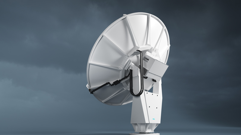
In addition to dropsondes, data from buoys and ships, satellites, soundings, weather radars, and lightning detection networks enhance hurricane observation and forecasting. For example, a Vaisala Weather Radar WRS200 in Punta Cana is providing crucial real-time data to the Dominican Republic’s Met Office, so people can take necessary actions to protect themselves and their property. This is also a great example of Vaisala’s commitment to enabling weather resilient nations as part of the World Meteorological Organization’s Early Warnings for All initiative.
Measurements to weather the storm
As we face the 2024 hurricane season, the fusion of instruments and intelligence – advanced meteorological tools and accurate observations – becomes our best defense. It is the partnerships between the academia, the public sector/federal government, and the private sector that exemplify how technology and collaboration can transform hurricane forecasting. By understanding and measuring hurricanes more precisely, we enable ourselves to model them effectively and, in turn, enhance our preparedness against these powerful natural forces.
*The NRD41 Dropsonde is manufactured by Vaisala under license from the University Corporation for Atmospheric Research. The NRD41, along with the aircraft data system hardware and software used by hurricane hunters, is developed by the Earth Observing Laboratory of the National Center for Atmospheric Research.


